
 |
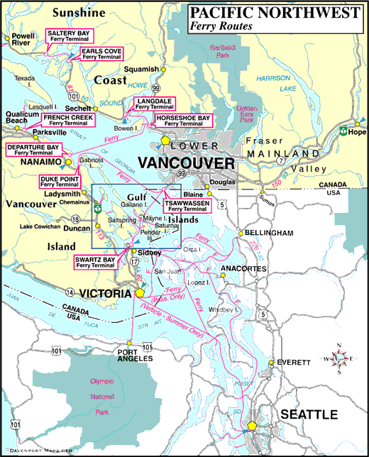
Information on Vancouver Island and BC Island communities shown on the map:
- Chemainus
- French Creek
- Gabriola Island
- Galiano Island
- Gulf Islands
- Penelakut Island (Kuper Island)
- Lasqueti Island
- Mayne Island
- Nanaimo
- Newcastle Island
- Northern Gulf Islands
- Parksville
- Pender Islands
- Qualicum Beach
- Quadra Island
- Saltspring Island
- Saturna Island
- Sidney
- Southern Gulf Islands
- Swartz Bay
- Texada Island
- Thetis Island
- Victoria
Information on BC Mainland communities shown on the map is accessible on our sister website, BritishColumbia.com at the link below:
- Map of Pacific Northwest Ferry Routes (link opens in a new window)
Information on ferry terminals and routes shown on the map:
Other Ferry Route Maps:


